3 min read
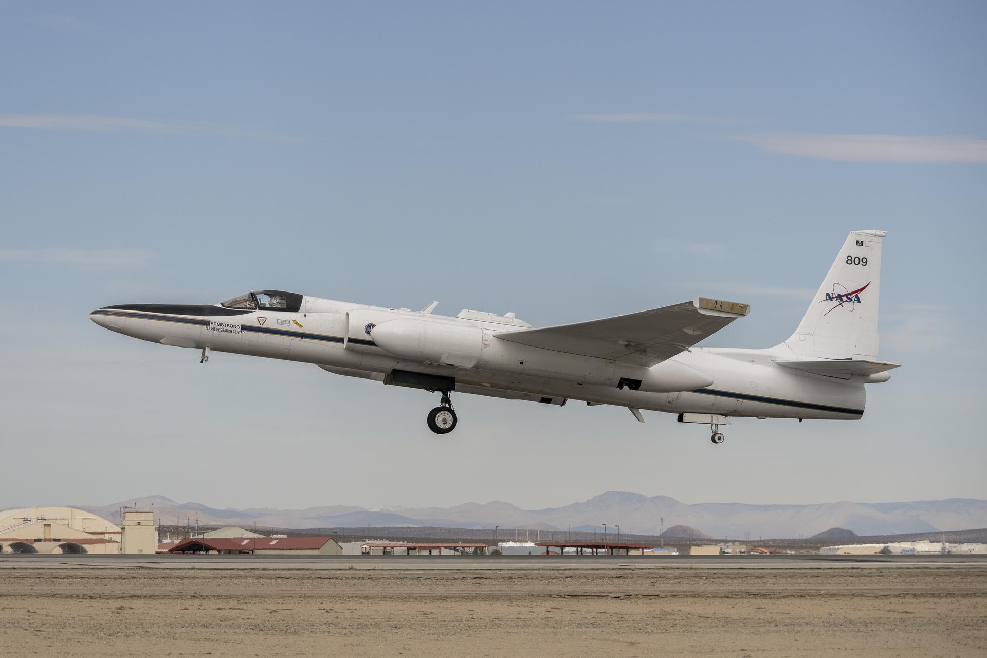
Preparations for Next Moonwalk Simulations Underway (and Underwater) Piloted by NASA’s Tim Williams, the ER-2 science aircraft ascends for one of the final science flights for the GSFC Lidar Observation and Validation Experiment (GLOVE) on Feb. 1, 2025. As a collaboration between engineers, scientists, and aircraft professionals, GLOVE aims to improve satellite data products for Earth Science applications. NASA/Steve FreemanIn February, NASA’s ER-2 science aircraft flew instruments designed to improve satellite data products and Earth science observations. From data collection to processing, satellite systems continue to advance, and NASA is exploring how instruments analyzing clouds can improve data measurement methods.
Researchers participating in the Goddard Space Flight Center Lidar Observation and Validation Experiment (GLOVE) used the ER-2 – based at NASA’s Armstrong Flight Research Center in Edwards, California – to validate satellite data about cloud and airborne particles in the Earth’s atmosphere. Scientists are using GLOVE instruments installed onboard the aircraft to measure and validate data about clouds generated by satellite sensors already orbiting in space around Earth.
“The GLOVE data will allow us to test new artificial intelligence algorithms in data processing,” said John Yorks, principal investigator for GLOVE and research physical scientist at NASA’s Goddard Space Flight Center in Greenbelt, Maryland. “These algorithms aim to improve the cloud and aerosol detection in data produced by the satellites.”
Jennifer Moore, a researcher from NASA’s Goddard Space Flight Center, checks the cabling on the Roscoe instrument at NASA’s Armstrong Flight Research Center in Edwards, California, for the GSFC Lidar Observation and Validation Experiment (GLOVE) on Feb. 1, 2025. The Roscoe instrument will be uploaded onto NASA’s ER-2 science aircraft.NASA/Steve FreemanThe validation provided by GLOVE is crucial because it ensures the accuracy and reliability of satellite data. “The instruments on the plane provide a higher resolution measurement ‘truth’ to ensure the data is a true representation of the atmospheric scene being sampled,” Yorks said.
The ER-2 flew over various parts of Oregon, Arizona, Utah, and Nevada, as well as over the Pacific Ocean off the coast of California. These regions reflected various types of atmospheres, including cirrus clouds, marine stratocumulus, rain and snow, and areas with multiple types of clouds.
“The goal is to improve satellite data products for Earth science applications,” Yorks said. “These measurements allow scientists and decision-makers to confidently use this satellite information for applications like weather forecasting and hazard monitoring.”
Researcher Jackson Begolka from the University of Iowa examines instrument connectors onboard the ER-2 aircraft at NASA’s Armstrong Flight Research Center in Edwards, California, on Feb. 1, 2025. The GLOVE instrument will validate data from satellites orbiting the Earth.NASA/Steve FreemanThe four instruments installed on the ER-2 were the Cloud Physics Lidar, the Roscoe Lidar, the enhanced Moderate Resolution Imaging Spectroradiometer Airborne Simulator, and the Cloud Radar System. These instruments validate data produced by sensors on NASA’s Ice, Cloud, and Land Elevation Satellite 2 (ICESat-2) and the Earth Cloud, Aerosol and Radiation Explorer (EarthCARE), a joint venture between the ESA (European Space Agency) and JAXA (Japan Aerospace Exploration Agency).
“Additionally, the EarthCARE satellite is flying the first ever Doppler radar for measurements of air motions within clouds,” Yorks said. While the ER-2 is operated by pilots and aircrew from NASA Armstrong, these instruments are supported by scientists from NASA Goddard, NASA’s Ames Research Center in California’s Silicon Valley, and the Naval Research Laboratory office in Monterey, California, as well as by students from the University of Iowa in Iowa City and the University of Maryland College Park.
Share
Details
Last Updated Apr 16, 2025 EditorDede DiniusContactErica HeimLocationArmstrong Flight Research CenterRelated Terms
Armstrong Flight Research CenterAirborne ScienceEarth ScienceEarth Science Technology OfficeEarth's AtmosphereER-2Goddard Space Flight CenterExplore More
4 min readHubble Provides New View of Galactic Favorite
As part of ESA/Hubble’s 35th anniversary celebrations, the European Space Agency (ESA) is sharing a new…
Article 9 hours ago 4 min readNASA Aims to Fly First Quantum Sensor for Gravity Measurements
Researchers from NASA’s Jet Propulsion Laboratory in Southern California, private companies, and academic institutions are…
Article 1 day ago 5 min readCan Solar Wind Make Water on Moon? NASA Experiment Shows Maybe
Scientists have hypothesized since the 1960s that the Sun is a source of ingredients that…
Article 1 day ago Keep ExploringDiscover More Topics From NASA
Armstrong Flight Research Center
Humans in Space
Climate Change
Solar System
Read More Details
Finally We wish PressBee provided you with enough information of ( Testing in the Clouds: NASA Flies to Improve Satellite Data )
Also on site :
- Palestinian activist Khalil denied release for son’s birth, wife says
- Education Ministry rehabilitates 70 schools since Assad regime’s fall
- Pope Francis’s will in full: Pontiff’s final wishes and place of burial

